Can You Name the State From an Image?

Estimated Completion Time
3 min
Can You Name the State From an Image?
Image: Shutterstock

About This Quiz

Hawaii was the last one, but do you know which one was first?

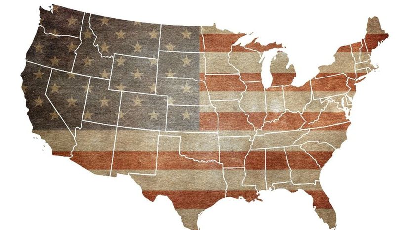
The United States of America is fairly young as countries go; however, there is no denying just how influential it has been on a global scale. The states that make up the United States of America range from skyscraper filled places like New York to tropical islands like Hawaii; or from huge frigid landmasses like Alaska to tiny plots of land like Rhode Island. There are exactly 50 states in the U.S., the perfect number for one of our quizzes!

The United States itself is huge, but some of the states that make it up are huge by themselves as well; with some of them being larger than a lot of countries around the world. Did you know that Texas is larger than France and the U.S. is almost as big as all of Europe? In fact, the states may all be a part of the United States, but their cultural and geographical differences make each one seem like a separate country at times!

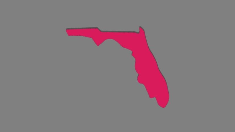
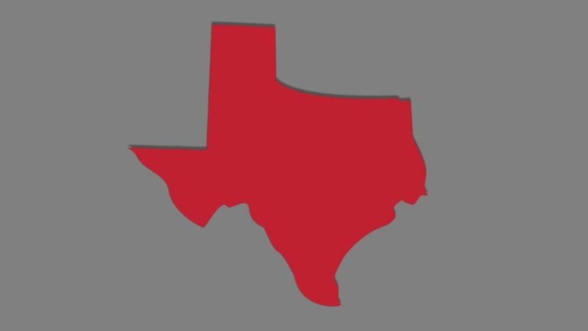
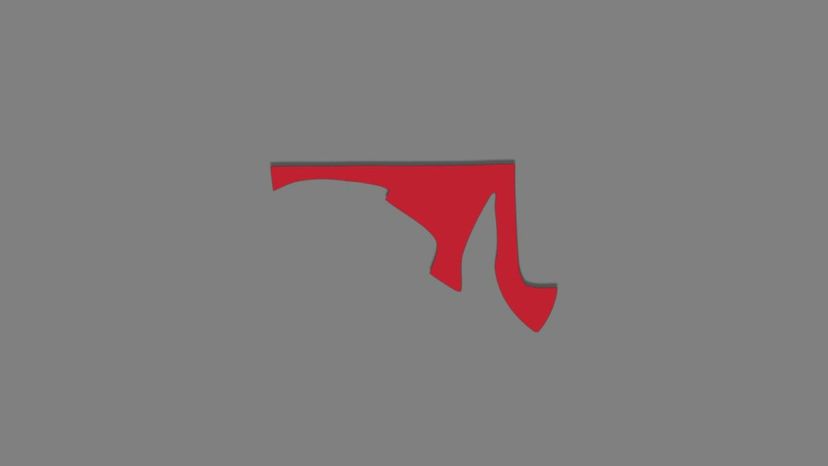
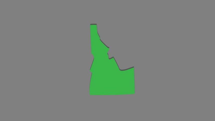
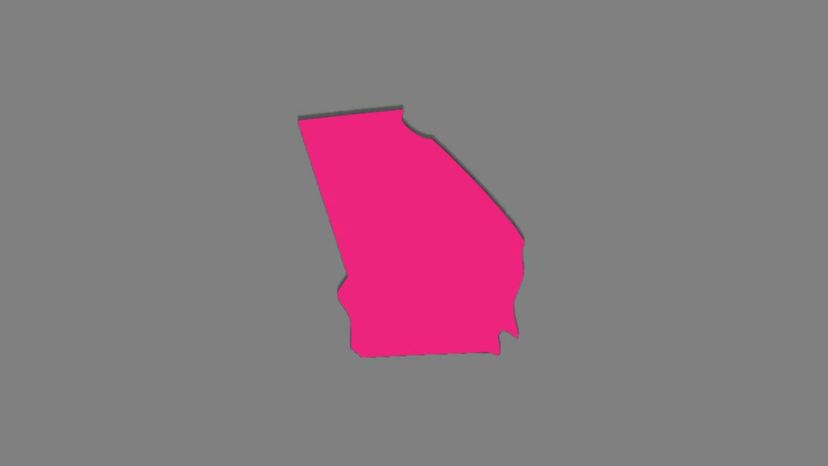
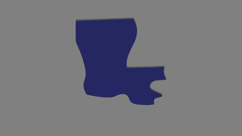
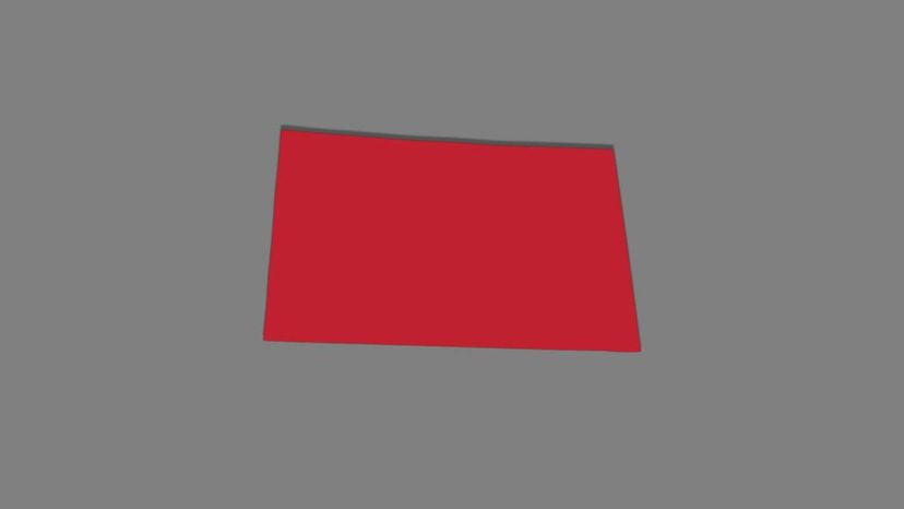
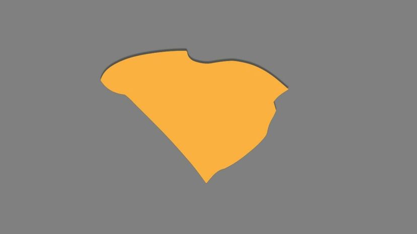
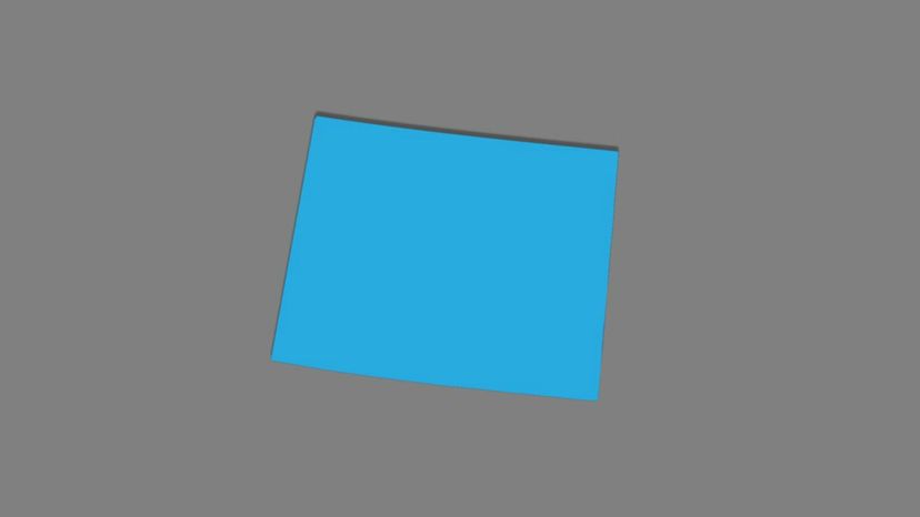
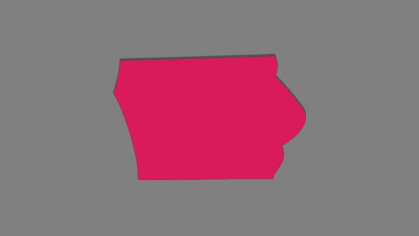
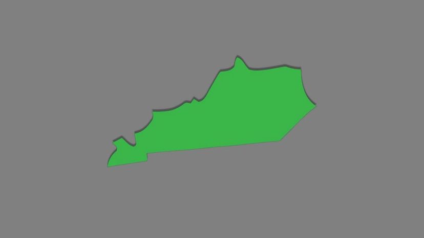
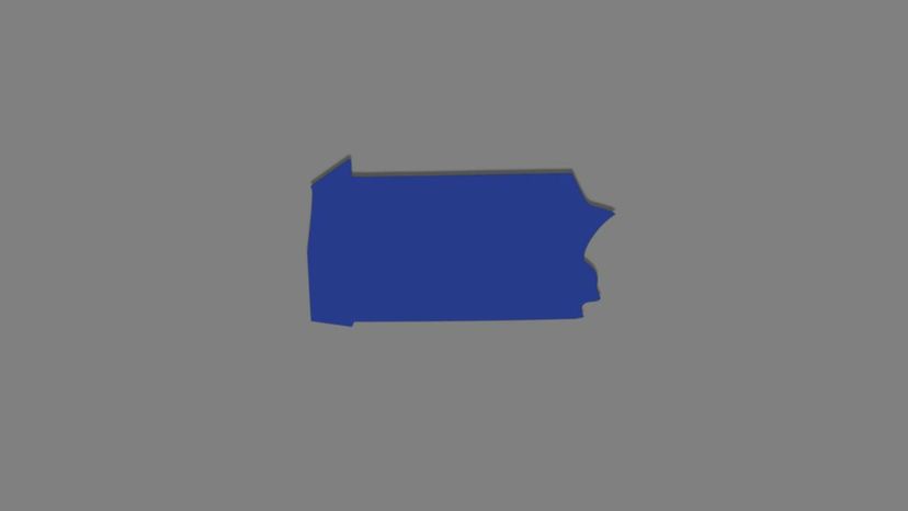
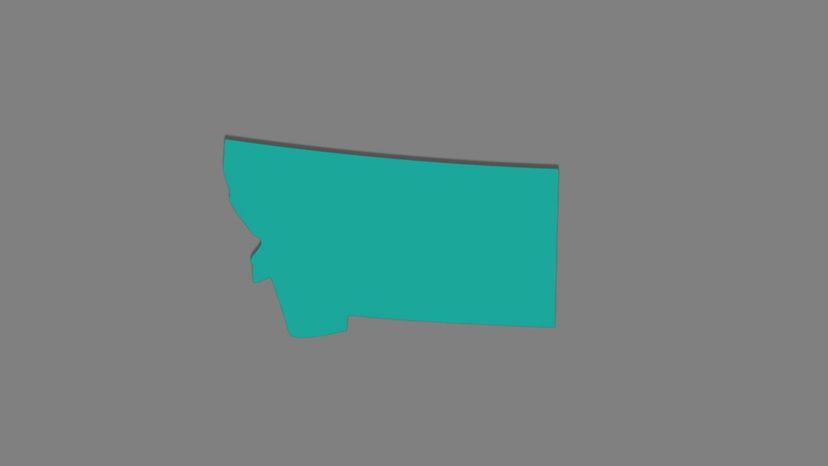
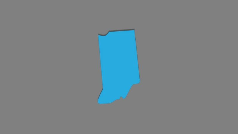
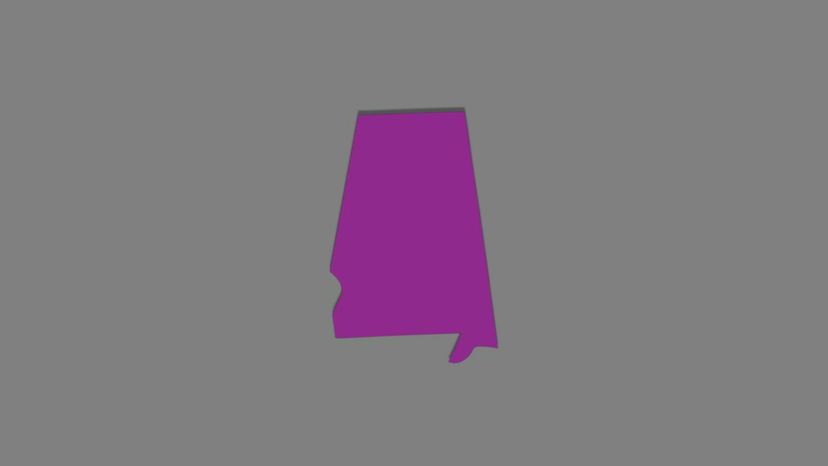
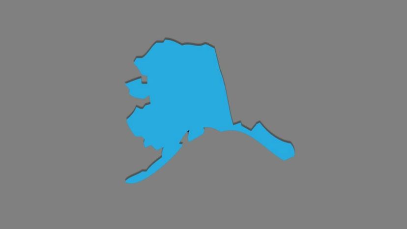
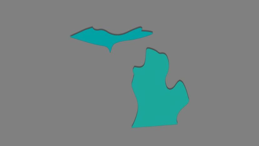
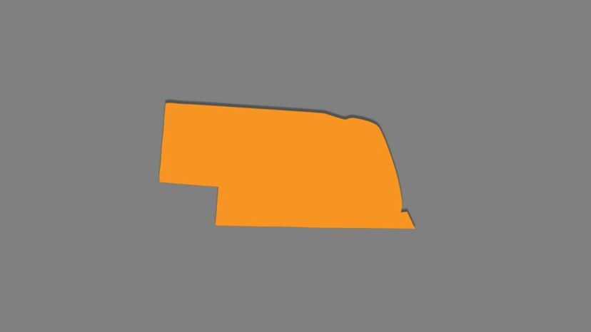
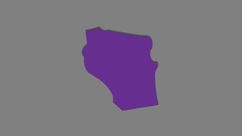
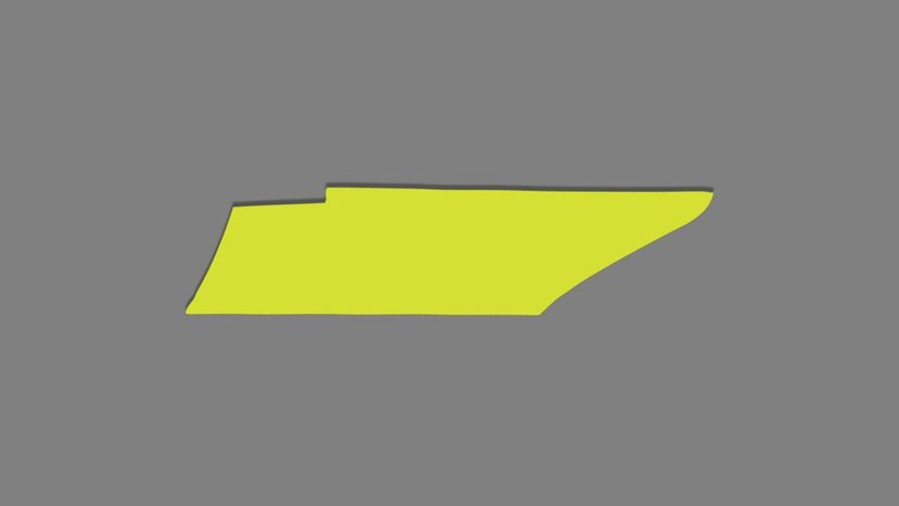
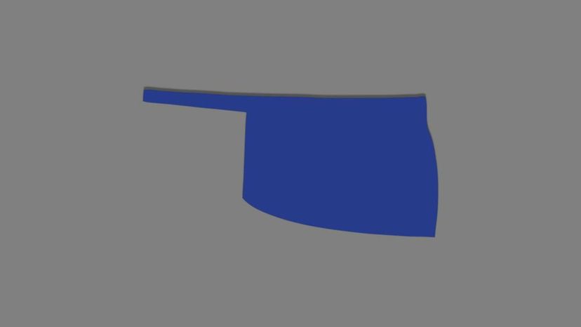
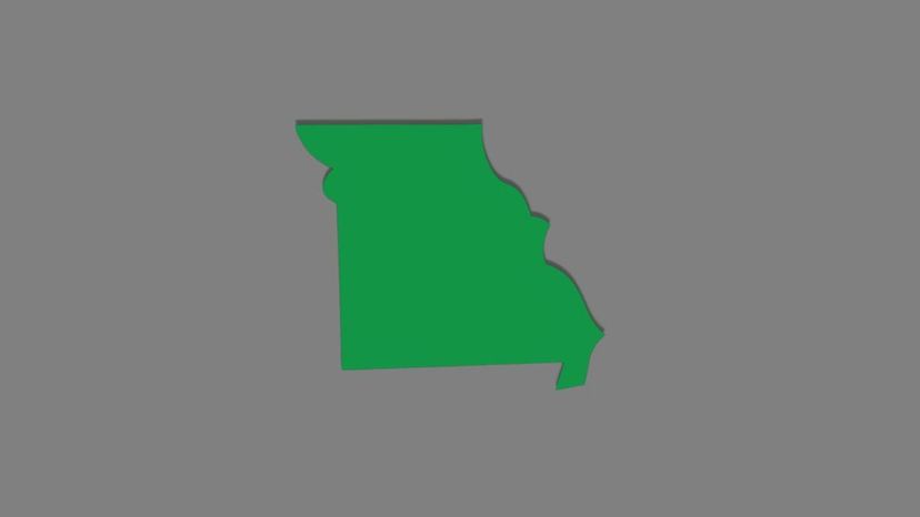
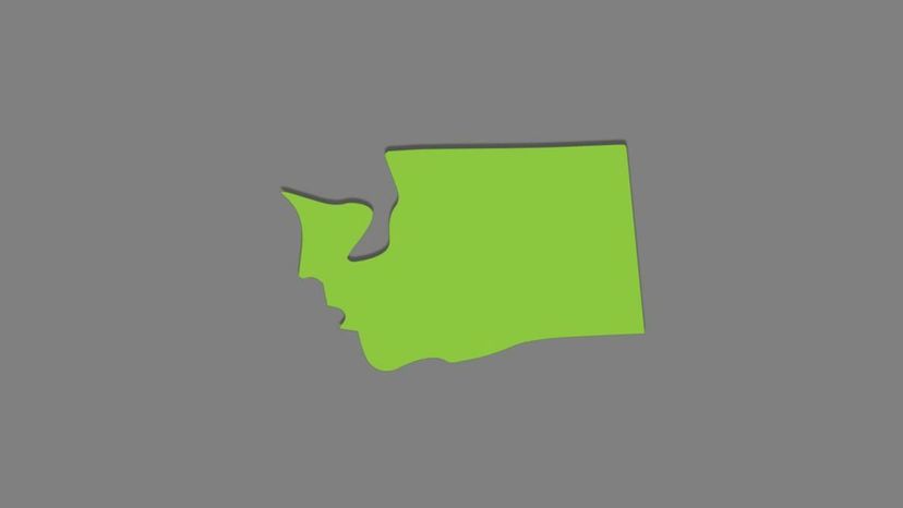
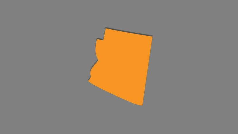
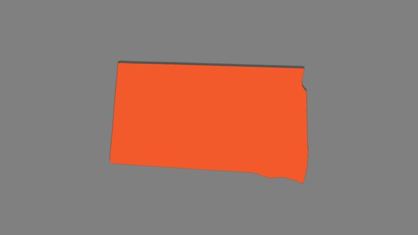
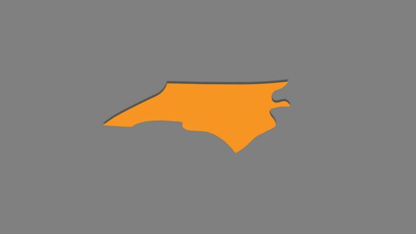
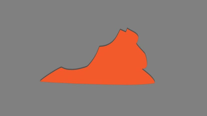
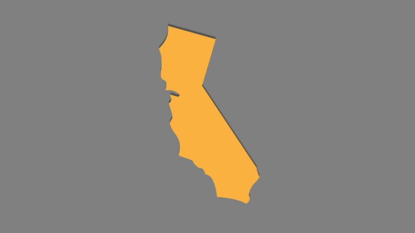
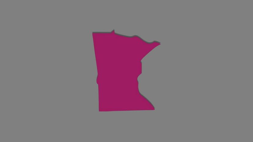
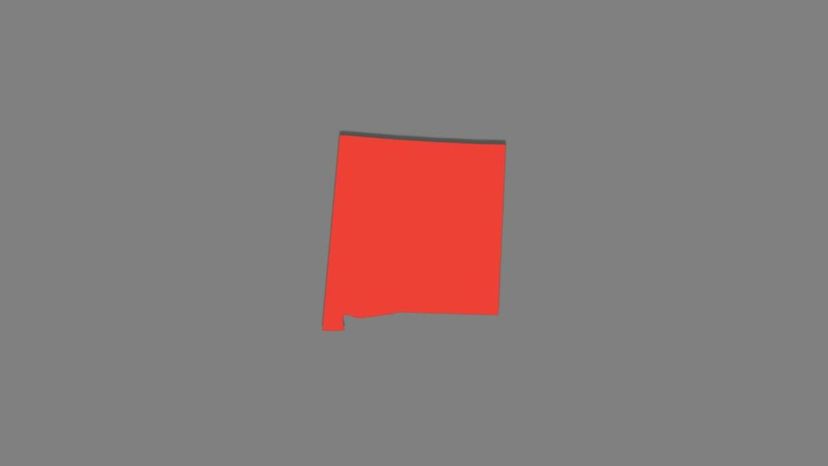
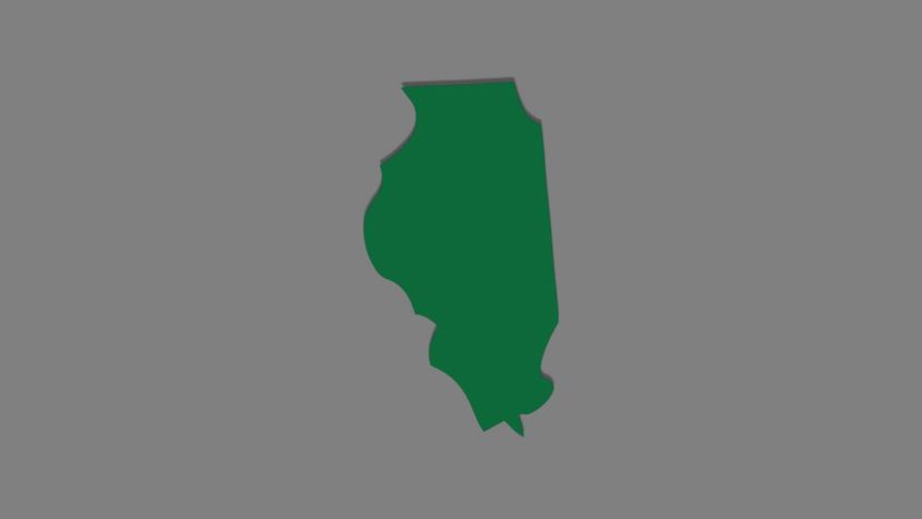
So, are you ready to go back to basics with this quiz? Look at the images of these states and let's see if your elementary school knowledge is still intact!

Texas (right side up)
n/a
Which U.S. state is shown in this image?
Wyoming
Texas
Texas is the 2nd-largest state in the United States. It is home to about 27 million people and its capital city is Austin.
Colorado
Oklahoma
Maryland (right side up)
n/a
Which U.S. state is shown in this image?
Nevada
Utah
Maryland
The capital of Maryland is Annapolis and its biggest city is Baltimore. Its abbreviation is MD and it became a state on April 28, 1788.
Washington
Idaho (right side up)
n/a
Which U.S. state is shown in this image?
Idaho
The capital and largest city of Idaho is Boise. Idaho became a state in 1890 and is the 14th-largest state in the United States.
North Carolina
Georgia
New Hampshire

Advertisement

Georgia (right side up)
n/a
Which U.S. state is shown in this image?
Florida
Michigan
North Dakota
Georgia
The capital of Georgia is Atlanta. Abbreviated GA, the state was founded on January 2, 1788.
Maine (right side up)
n/a
Which U.S. state is shown in this image?
Maine
Maine is the northeast-most state in the United States. Its capital is Augusta and its largest city is Portland. It became the 23rd state on March 15, 1820.
Rhode Island
Texas
New Mexico
Louisiana (right side up)
n/a
Which U.S. state is shown in this image?
Ohio
Indiana
Louisiana
Louisiana is nicknamed the Pelican State. It was the 18th state to become part of the United States and its capital is Baton Rouge.
West Virginia

Advertisement

North Dakota (right side up)
n/a
Which U.S. state is shown in this image?
Michigan
Ohio
North Dakota
North Dakota is inhabited by more than 642,000 people. Its capital city is Bismark while its largest city is Fargo.
Florida
Massachusetts (right side up)
n/a
Which U.S. state is shown in this image?
New Jersey
New Mexico
New Hampshire
Massachusetts
Nicknamed the Bay State, Massachusetts is located in the Northeast and borders the states of Rhode Island, Connecticut, New York, Vermont and New Hampshire! Its capital and largest city is Boston.
Nevada (right side up)
n/a
Which U.S. state is shown in this image?
Nevada
Nevada's capital city is Carson City, while its largest city is Las Vegas. Originally part of Mexican territory, Nevada became part of the United States in 1861.
Oregon
Wisconsin
Iowa

Advertisement

West Virginia (right side up)
n/a
Which U.S. state is shown in this image?
Delaware
Kentucky
Mississippi
West Virginia
West Virginia is abbreviated WV. Though once part of Virginia, it became its own state in 1863. Its capital and largest city is Charleston.
New York (right side up)
n/a
Which U.S. state is shown in this image?
Massachusetts
New York
The state of New York is abbreviated as NY. Its capital is Albany and it officially became a state on July 26, 1788.
Delaware
California
Wyoming (right side up)
n/a
Which U.S. state is shown in this image?
Wyoming
Wyoming is the state with the fewest people in the U.S. with approximately 576,412 people. Its capital and biggest city is Cheyenne.
Alaska
Mississippi
Arkansas

Advertisement

South Carolina (right side up)
n/a
Which U.S. state is shown in this image?
Alaska
Colorado
South Carolina
The capital of South Carolina is Columbia, though back from 1670 - 1789 it was Charleston. It is home to about 4.2 million people.
Indiana
Ohio (right side up)
n/a
Which U.S. state is shown in this image?
Hawaii
Kentucky
Ohio
The Buckeye State, Ohio became part of the United States on March 1, 1803. There have been seven American presidents from Ohio: Ulysses S. Grant, Rutherford Hayes, James Garfield, Benjamin Harrison, William McKinley, William Howard Taft, Warren G. Harding.
Connecticut
New Hampshire (right side up)
n/a
Which U.S. state is shown in this image?
Texas
Alaska
California
New Hampshire
New Hampshire's capital is Concord, while its largest city is Manchester. It is located in the New England region of the United States.

Advertisement

Colorado (right side up)
n/a
Which U.S. state is shown in this image?
Colorado
Colorado became a state in 1876. It is the first state in US history to have legalized the use and possession of marijuana.
South Dakota
South Carolina
Virginia
Iowa (right side up)
n/a
Which U.S. state is shown in this image?
Pennsylvania
Wisconsin
Iowa
The Hawkeye State, Iowa is located in the Midwestern United States. Its capital and largest city is Des Moines.
Alabama
Delaware (right side up)
n/a
Which U.S. state is shown in this image?
Washington
Delaware
Delaware is sometimes called the First State because it was the first colony to accept the new constitution in 1787. Its capital is Dover.
Rhode Island
South Dakota

Advertisement

Kentucky (right side up)
n/a
Which U.S. state is shown in this image?
Virginia
Missouri
Kentucky
The capital of Kentucky is Frankfort, and its largest city is Louisville. It is nicknamed the Bluegrass State because of a special kind of grass that grows there.
Vermont
Pennsylvania (right side up)
n/a
Which U.S. state is shown in this image?
Pennsylvania
Pennsylvania is located in the northeastern part of the country. It has a border with Ohio on the west, West Virginia on the south and west, Maryland and Delaware on the south, New Jersey on the east and New York and Lake Erie on the north.
New Hampshire
Massachusetts
Connecticut
Connecticut (right side up)
n/a
Which U.S. state is shown in this image?
New Mexico
Utah
Florida
Connecticut
Connecticut is the 48th largest, or shall we say 3rd smallest US state. Its capital is Hartford and it became part of the US on January 9, 1788.

Advertisement

Montana (right side up)
n/a
Which U.S. state is shown in this image?
Idaho
Montana
Montana is located in the Northwest region of the United States. It is the 4th-largest state with its capital Helena. Montana shares a 545 mile border with Canada.
Louisiana
South Carolina
Hawaii (right side up)
n/a
Which U.S. state is shown in this image?
Alaska
Texas
Hawaii
Hawaii was the last state to join the United States. it officially became a state on August 21, 1959. The capital and largest city is Honolulu.
Illinois
Indiana (right side up)
n/a
Which U.S. state is shown in this image?
Nebraska
Wyoming
Indiana
Indiana is located in the Midwestern and Great Lakes region of the United States. Its capital and largest city is Indianapolis.
Arizona

Advertisement

New Jersey (right side up)
n/a
Which U.S. state is shown in this image?
Tennessee
New Jersey
Nicknamed the Garden State, New Jersey is located along the East Coast of the United States. Its capital is Trenton while its largest city is Newark. It is the 4th-smallest state.
Mississippi
Kansas
Mississippi (right side up)
n/a
Which U.S. state is shown in this image?
Mississippi
Mississippi's capital and largest city is Jackson. The state flower and tree are the magnolia.
Vermont
Maryland
Alabama
Alaska (right side up)
n/a
Which U.S. state is shown in this image?
Minnesota
Alaska
Alaska is the largest state in the United States, though it is the 4th least populated! Its capital is Juneau. "Juneau the capital of Alaska?"
Montana
Missouri

Advertisement

Michigan (right side up)
n/a
Which U.S. state is shown in this image?
New York
Maine
Michigan
The capital of Michigan is Lansing, while the largest city is Detroit. The state is made up of two peninsulas which are connected by the Mackinac Bridge.
Georgia
Nebraska (right side up)
n/a
Which U.S. state is shown in this image?
Ohio
Kentucky
Arizona
Nebraska
Nebraska is a state in the center of the United States. Its capital is Lincoln and the largest city is Omaha. It is known for its agriculture, especially beef and corn.
Arkansas (right side up)
n/a
Which U.S. state is shown in this image?
Arkansas
Arkansas was the 25th state to join the Union in 1836. Its capital and largest city is Little Rock.
Idaho
Washington
California

Advertisement

Wisconsin (right side up)
n/a
Which U.S. state is shown in this image?
Idaho
Wisconsin
The capital of Wisconsin is Madison. It became a state on May 29, 1848 and its current governor is Scott Walker.
Ohio
New Mexico
Alabama (right side up)
n/a
Which U.S. state is shown in this image?
Maine
South Carolina
Alabama
Alabama became a state on December 14, 1819. Its capital is Montgomery and its largest city is Birmingham.
West Virginia
Vermont (right side up)
n/a
Which U.S. state is shown in this image?
Wisconsin
Vermont
Known as The Green Mountain State, Vermont became a state on March 4, 1791. It is home to only about 625,000 people.
Texas
Arizona

Advertisement

Tennessee (right side up)
n/a
Which U.S. state is shown in this image?
Montana
Tennessee
Tennessee is known as The Volunteer State. Its capital is Nashville, which is also the country music center of America.
Kentucky
Vermont
Oklahoma (right side up)
n/a
Which U.S. state is shown in this image?
Michigan
Minnesota
Oklahoma
The Sooner State, Oklahoma, became part of the United States on November 16, 1907. Its population is around 3.7 million people.
Wisconsin
Missouri (right side up)
n/a
Which U.S. state is shown in this image?
Mississippi
Oklahoma
Missouri
Missouri officially became a state on August 10, 1821. Its capital is Jefferson City and it is inhabited by more than 5.5 million people.
Kansas

Advertisement

Washington (right side up)
n/a
Which U.S. state is shown in this image?
Utah
Washington
The state of Washington is located in the Northwest section of the country. It is north of Oregon, west of Idaho, east of the Pacific Ocean, and south of British Columbia, and has more than 6.7 million residents.
North Carolina
Maryland
Arizona (right side up)
n/a
Which U.S. state is shown in this image?
Pennsylvania
Arizona
Home of The Grand Canyon, Arizona is located in Southwestern United States. Its capital and largest city is Phoenix.
Connecticut
Louisiana
South Dakota (right side up)
n/a
Which U.S. state is shown in this image?
South Dakota
Home of Mount Rushmore, South Dakota became a state on November 2, 1889. Its capital is Pierre and largest city is Sioux Falls.
Iowa
Illinois
Indiana

Advertisement

Rhode Island (right side up)
n/a
Which U.S. state is shown in this image?
Arkansas
Missouri
Nevada
Rhode Island
Rhode Island is the smallest state in the country. Its capital and largest city is Providence and the state is home to about 1 million people.
North Carolina (right side up)
n/a
Which U.S. state is shown in this image?
South Dakota
North Carolina
North Carolina is abbreviated NC. It was one of the original 13 colonies. It became an official state on November 21, 1789.
Colorado
Montana
Virginia (right side up)
n/a
Which U.S. state is shown in this image?
Ohio
Texas
Virginia
The Commonwealth of Virginia became a state in 1788 following the American Revolution. Its capital city is Richmond and the state is home to about 7.5 million people.
Hawaii

Advertisement

California (right side up)
n/a
Which U.S. state is shown in this image?
Alaska
Hawaii
California
California is the 3rd-largest state in the country. It is the number 1 most populated state in the country! It became part of the United States on September 9, 1850.
Florida
Minnesota (right side up)
n/a
Which U.S. state is shown in this image?
Minnesota
Minnesota is located in the Upper Midwest section of the United States. Its capital city is Saint Paul, while its largest city is Minneapolis, home of the Vikings, their NFL team.
Georgia
Rhode Island
New Hampshire
Oregon (right side up)
n/a
Which U.S. state is shown in this image?
Oregon
Oregon became the 33rd state to join the United States in 1859. Its capital is Salem, though often confused for its largest city, Portland.
Massachusetts
New York
Louisiana

Advertisement

Utah (right side up)
n/a
Which U.S. state is shown in this image?
Nebraska
Wisconsin
Utah
Utah became a state on January 4, 1896. Its capital and largest city is Salt Lake City. Utah is home to about 2.7 million residents.
Oklahoma
New Mexico (right side up)
n/a
Which U.S. state is shown in this image?
Iowa
Illinois
Florida
New Mexico
New Mexico is part of the Southwest region of the country. It is bordered by Texas to the east, Oklahoma to the northeast, Colorado to the north, and Arizona to the west. The northwest corner of the state also touches Utah.
Illinois (right side up)
n/a
Which U.S. state is shown in this image?
Maine
Oregon
New Mexico
Illinois
Illinois became part of the United States in 1818. It was the first state to ratify the 13th Amendment to the Constitution, which helped abolish slavery in the United States.

Advertisement

Florida (right side up)
n/a
Which U.S. state is shown in this image?
Indiana
Michigan
New Hampshire
Florida
Nicknamed the Sunshine State, Florida's capital is Tallahassee. It became a state on March 3, 1845 and is now home to about 18.8 million people.
Kansas (right side up)
n/a
Which U.S. state is shown in this image?
Kansas
Kansas is located in the middle of America. Its capital is Topeka and its largest city is Wichita. It was the 34th state to be admitted to the United States in 1861.
Pennsylvania
South Carolina
North Carolina
You Got:
/50
Shutterstock