Can You Pass This Basic Geography Test?

By: Jacqueline Samaroo
Estimated Completion Time
3 min
Can You Pass This Basic Geography Test?
Image: Youtube via American Eye

About This Quiz

Does geography rock your world? Then it's time for some major fun and excitement as we put you through your paces with this awesome geo quiz!

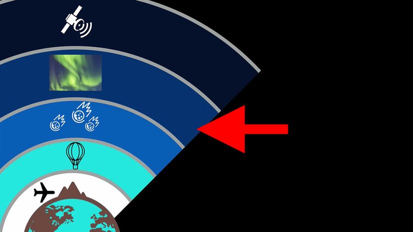
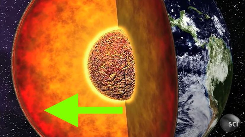
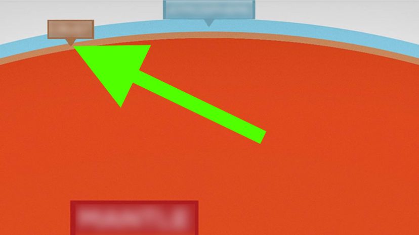
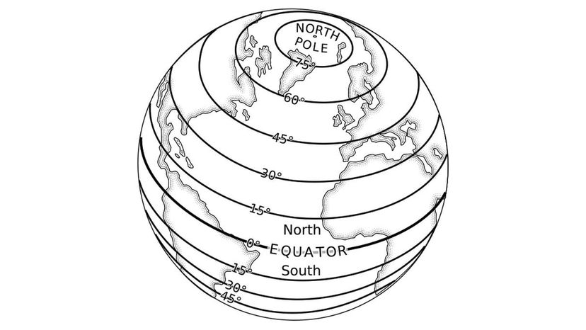
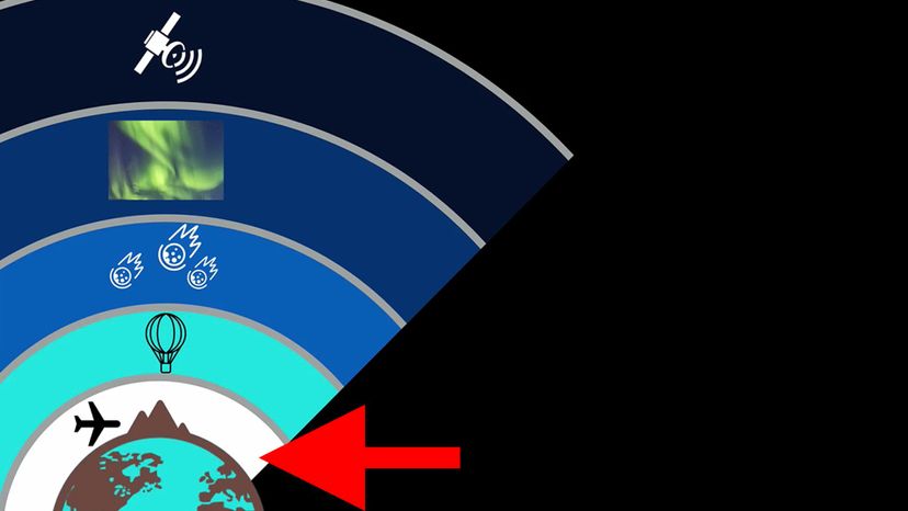
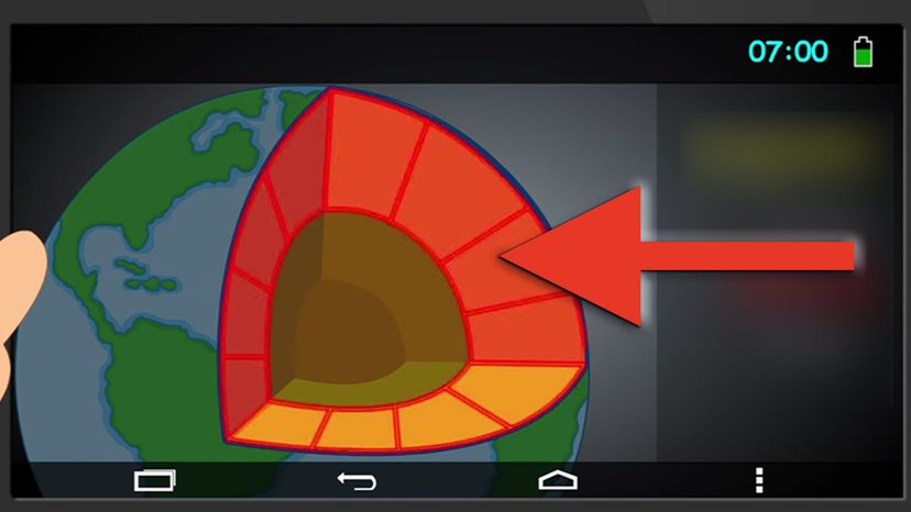
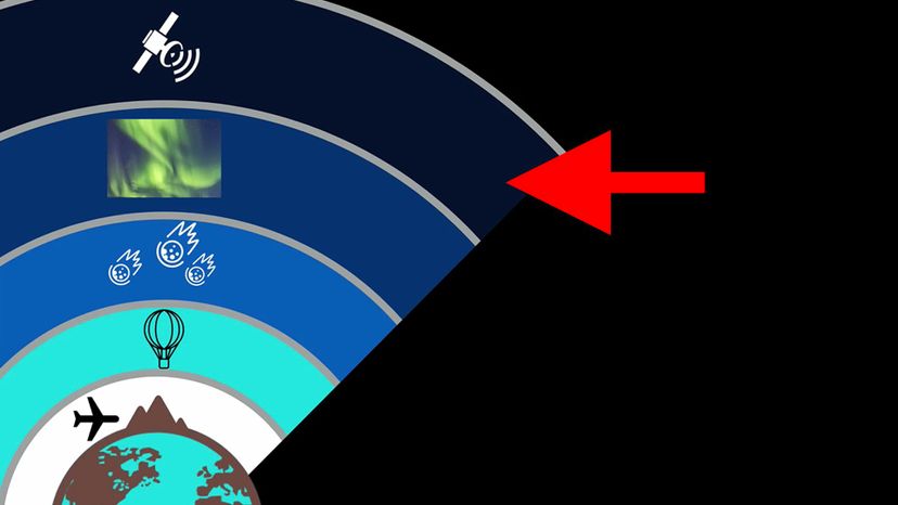
Geography takes in all aspects of the Earth - inside and out. So, if you really know a great deal about geography, then you know all about the different sections of the Earth and the layers of the atmosphere. If you can tell mantle from exosphere, then this quiz is perfect for you!

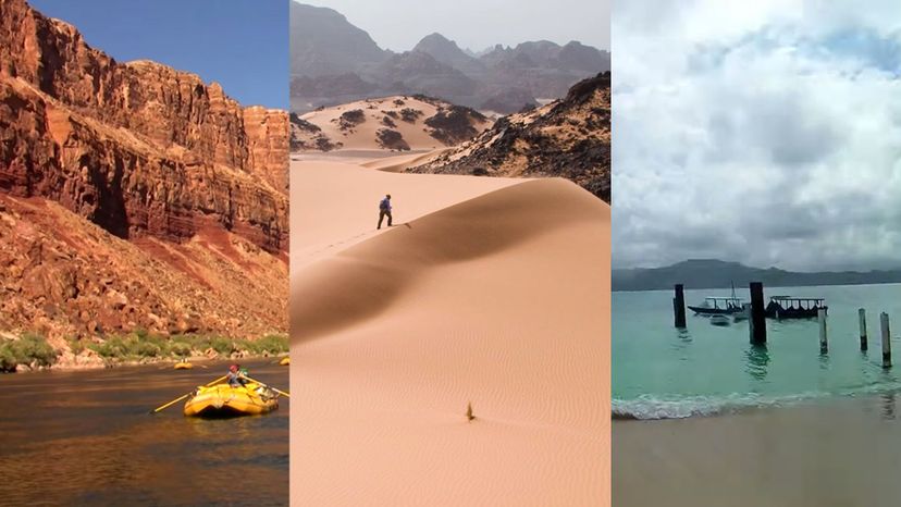
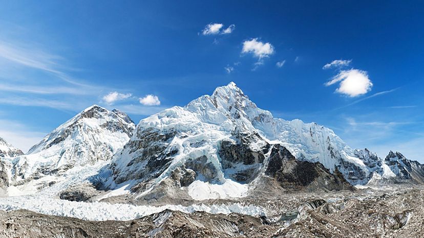
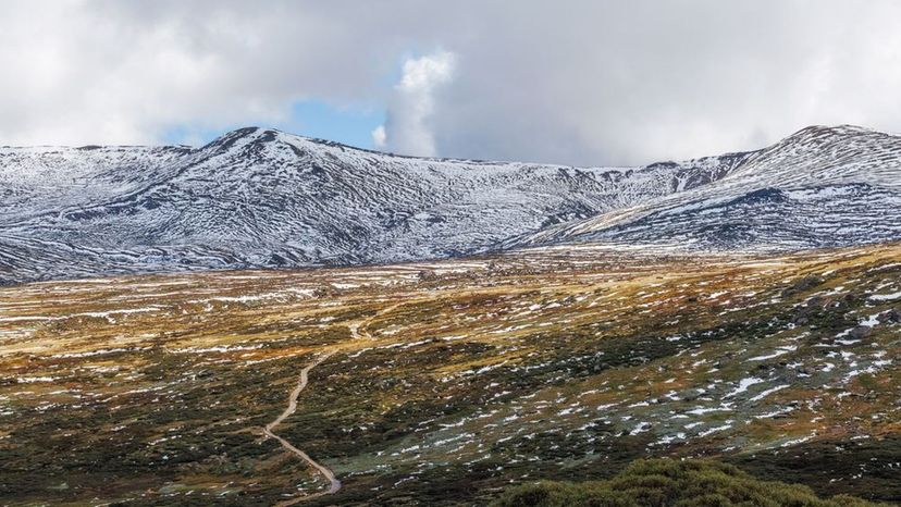
One fascinating aspect of geography is identifying the most outstanding features of the planet, such as its longest river, deepest trench and highest mountain. Speaking of mountains, we know everybody can probably name the Earth's highest mountain but can you name the highest one on each continent? We put a couple of them in here, just for fun!

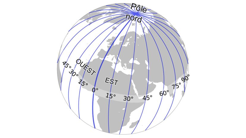
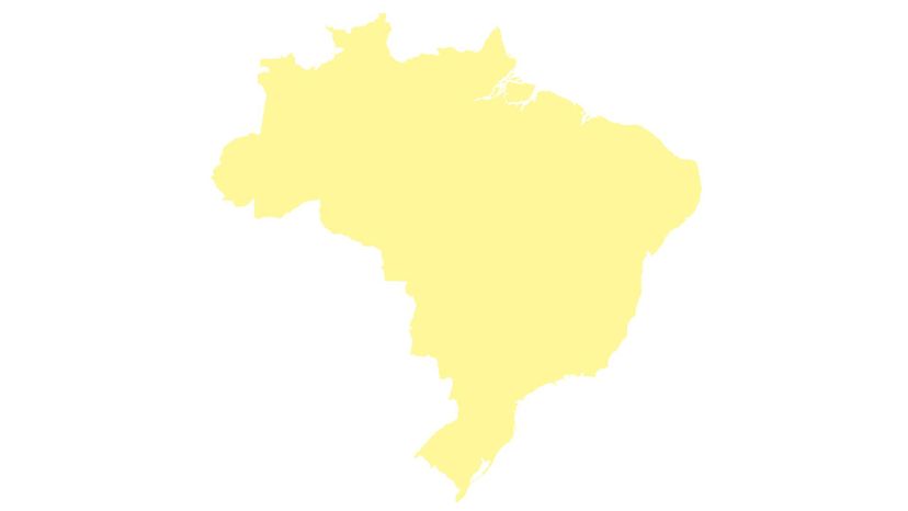
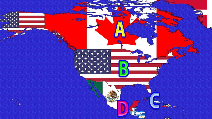
Human societies also fall into the study of geography - countries, cities, states and populations are all covered in this subject area. You'll have to know quite a bit of geography to remember them all. Such as, which two U.S. states hold the titles for largest and smallest or which two countries share the longest land border. If you know those, then you've come to the right place!

Basic geography knowledge isn't a simple thing - the subject is too wide and exciting tor that! To truly ace this quiz and claim the title of "Geography Pro" means knowing every area of geography. If you do, prove it - take the quiz!

Lines of Longitude
Wiki commons
Which imaginary lines run from the North Pole to the South Pole?
lines of longitude
The lines of longitude are also called meridians. Each one stretches from the North Pole to the South Pole and two meridians on opposite sides of the globe from each other form a great circle which divides the globe into hemispheres. Unlike lines of latitude which get smaller as they move away from the Equator, all lines of longitude are the same length.
mantle
Pacific Ocean
outer core

Advertisement

Thermometer
Shutterstock
Which device measures temperature?
exosphere
thermometer
While there are many different types of thermometers, each is essentially used to do the same thing – measure temperature. On maps, areas that have the same temperature can be joined by special contour lines known as isotherms.
igneous rock
inner core

Advertisement

Atlantic Ocean
Shutterstock
Which ocean lies on the U.S. East Coast?
Colorado River
Atlantic Ocean
The Atlantic Ocean covers nearly one-fifth of the surface of the Earth. It is the second largest ocean but is only about half the size of the Pacific Ocean (Earth’s largest). The Equator divides the Atlantic Ocean into the North Atlantic and South Atlantic Oceans.
Equator
Angel Falls, Venezuela

Advertisement

mount everest
Shutterstock
Which is the world’s tallest mountain?
Alaska
Vatican City
Mount Everest
Mount Everest rises to approximately 29,035 feet, making it the highest point on Earth. It is found in the Great Himalayas of southern Asia on the border between Nepal and Tibet. In Tibetan, its name means “Goddess Mother of the World” while its Sanskrit name translates to “Peak of Heaven.”
Marianas Trench

Advertisement

outer core – Which section of the Earth is indicated here?
Youtube via Science Channel
Which section of the Earth is indicated here?
Denali/Mt. McKinley
troposphere
outer core
The Earth’s outer core is a fluid layer made up of iron and nickel with trace amounts of some other elements. It is approximately 1,500 miles thick and lies between the solid inner core and the mostly solid mantle. The outer core contributes to the Earth’s magnetic field.
anemometer

Advertisement

INNER core – Which section of the Earth is indicated here? copy
Youtube via Science Channel
Which section of the Earth is indicated here?
Atlantic Ocean
Angel Falls, Venezuela
inner core
The Earth’s inner core is a solid ball of mostly iron and nickel (with traces of other elements). It measures roughly 1,500 miles across and has a temperature which is about the same as the temperature at the surface of the Sun.
barometer

Advertisement

Equator
Wiki commons
Which imaginary line divides the Earth into Northern and Southern Hemispheres?
stratosphere
outer core
metamorphic rock
Equator
The Equator is an imaginary line circling the Earth at equal distances from the North and South Poles. It is regarded as the zero degrees line of latitude and is the only line of latitude which is also a great circle – dividing the globe into two halves or hemispheres.

Advertisement

Colorado River
Youtube
Which major river flows through the Grand Canyon?
Green River
Caribbean Sea
Marianas Trench
Colorado River
The Colorado River has its beginnings in the Rocky Mountains in the northern region of the state of Colorado. It travels in a more or less southwesterly direction for close to 1,500 miles before emptying into the Gulf of California in Mexico. The river cuts several canyons along the way but the most spectacular of these is the immense Grand Canyon in Arizona.

Advertisement

Mount Kosciuszko
Shutterstock
What is the tallest mountain in Australia?
Hawai’i
Mount Kosciuszko
The mountain that is now called Mount Kosciuszko used to be named Mount Townsend and was thought to be lower than its neighbor, which at the time was named Mount Kosciuszko and regarded as the highest mountain in Australia. When officials realized the error, they simply switched the mountains’ names, which means the country’s highest mountain got to keep the name Mount Kosciuszko.
Mount Everest
Honshu

Advertisement

Hawai’i – Which is the largest Hawaiian Island?
Youtube via Kids Learning Tube
Which is the largest Hawaiian Island?
Asia
Hawai’i
The state of Hawaii is reported to include 137 islands of which the island of Hawai’i is the largest. It is roughly twice the size of all the other islands combined and is aptly called the “Big Island.”
Vatican City
Atlantic Ocean

Advertisement

oceanography – Which term is used for the study of physical and biological properties of the sea? copy
Youtube via Wiz Science
Which term is used for the study of physical and biological properties of the sea?
oceanography
This very wide branch of science can be broken down into four major areas. These are marine ecology, marine geology physical oceanography, and chemical oceanography.
crust
thermometer
troposphere

Advertisement

Rhode Island
n/a
Which is the smallest U.S. state?
Russia
Sicily
Rhode Island
The official name of America’s smallest state is The State of Rhode Island and Providence Plantations. It was one of the country’s original 13 colonies and is now one of the six states which make up the geographical region known as New Englands.
Florida

Advertisement

Pacific Ocean
Shutterstock
Which ocean lies on the west coast of the U.S.?
Indian Ocean
Atlantic Ocean
Dead Sea
Pacific Ocean
The Pacific Ocean covers one-third of the Earth’s surface. It is the largest ocean and, in terms of both area and volume, it is at least twice the size of the second largest ocean (the Atlantic). The Pacific Ocean is also larger than Earth’s combined land area.

Advertisement

Honshu – What is the name of the largest island in Japan
Youtube via Geography Now
What is the name of the largest island in Japan?
Honshu
Japan is an archipelago made of nearly 7,000 islands. Of these, the largest and most populated is Honshu (which translates to “Main Island” or “Main Province”). Honshu is the seventh largest island in the world, smaller than sixth place Sumatra in Indonesia and larger than eighth place Victoria Island, Canada.
Mount Everest
Brazil
Mount Kosciuszko

Advertisement

Brazil
n/a
What is the largest country in South America?
Asia
Brazil
In terms of its size, Brazil is the fifth largest country in the world. It is also the largest country in South America, accounting for just about half of the continent’s land area. Brazil is also the country with the largest Portuguese-speaking population.
Sahara Desert
Venezuela

Advertisement

metamorphic rock – Which rock forms when another rock is changed by extreme heat and pressure?
Youtube via Free School
Which type of rock forms when another type of rock is changed by extreme heat and pressure?
Alaska
lines of latitude
metamorphic rock
Metamorphic rocks can be formed from preexisting igneous, sedimentary or other metamorphic rocks. Some examples are marble (formed from limestone) and slate (formed from mudstone).
Marianas Trench

Advertisement

Anemometer
Wiki commons
Which device measures wind speed?
thermometer
anemometer
The anemometer was first developed in the 15th century. Nowadays, there are several varieties of anemometers, with the revolving-cup anemometer being the most common among them. Other types include the propeller anemometer and the hot-wire anemometer.
slide ruler
measuring tape

Advertisement

crust – Which section of the Earth is indicated here? copy
Youtube via Kurzgesagt – In a Nutshell
Which section of the Earth is indicated here?
lines of longitude
cartography
rain gauge
crust
The crust is the Earth’s outermost layer, which is said to “float” on the semi-molten rock (a.k.a. magma) of the mantle underneath it. Earth’s crust is described as a thin shell since it accounts for less than 1 percent of the volume of the Earth. The crust varies in thickness from just 3 to 6 miles in some parts of the oceanic crust and up to 50 miles in some areas of the continental crust.

Advertisement

Lines of Latitude
Wiki commons
Which imaginary lines circle the Earth from east to west?
lines of latitude
The imaginary lines of latitude circle the Earth in an east-west direction. The Equator is at zero degrees latitude while the North Pole is at latitude 90 degrees north and the South Pole is at latitude 90 degrees south. Other major lines of latitude are the Arctic Circle, the Tropic of Cancer, the Tropic of Capricorn and the Antarctic Circle.
exosphere
mantle
cartography

Advertisement

barometer – Which device is used to measure atmospheric pressure? copy
Youtube via TED-Ed
What device measures atmospheric pressure?
troposphere
barometer
Barometers measure atmospheric pressure, which varies with distance above or below sea level. That means a barometer can be used to measure altitude, in which case, it is called an altimeter.
thermometer
slide ruler

Advertisement

Sahara Desert - Which is the largest hot desert in the world? copy
Youtube via American Eye
Which is the largest hot desert in the world?
Caribbean Sea
Sahara Desert
The Sahara Desert in Northern Africa is just slightly smaller than China or the United States of America. Technically speaking, the Sahara is the third largest desert on Earth. Both the Antarctic and Arctic are bigger than the Sahara and are also deserts since they have very little precipitation and their environmental conditions make it difficult for life to survive.
Canada and United States of America
Brazil

Advertisement

Russia – Which is the largest country in the world? copy
Youtube via Knowledgia
What is the largest country in the world?
United States
Mexico
Russia
Russia is the largest country in the world and one of several countries that are transcontinental (in both Europe and Asia). In fact, Russia occupies about 37 percent of Europe and roughly 30 percent of Asia. Over three-quarters of the Russian population live in the European section of the country.
Italy

Advertisement

Sicily
Shutterstock
Which is the largest island in the Mediterranean Sea?
Denali/Mt. McKinley
Colorado River
Vatican City
Sicily
Sicily is known as Sicilia in Italian. Apart from being the largest of the Mediterranean Islands, Sicily is also home to Mount Etna – the highest active volcano in all of Europe.

Advertisement

rain gauge – Which device is used to measure rainfall? copy
Youtube via The Grommet
Which device measures rainfall?
rain gauge
The rain gauge also goes by the more technical-sounding names of udometer, pluviometer, and ombrometer. It is used to measure the amount of liquid precipitation (such as rain and drizzle) over a specified time.
igneous rock
crust
lines of latitude

Advertisement

troposphere – Which section of Earth’s atmosphere is indicated here?
Youtube via Bozeman Science
Which section of the Earth’s atmosphere is indicated here?
troposphere
The troposphere is the lowest level of the Earth’s atmosphere. It is between 4 and 12 miles wide with the surface of the Earth below it and the stratosphere above it. The troposphere contains nearly all of the Earth’s clouds and weather systems.
Equator
Honshu
thermometer

Advertisement

cartography – Which term is used for the science or practice of drawing maps?
Youtube via Wiz Science
Which term is used for the science or practice of drawing maps?
cartography
Map making has been traced back to ancient civilizations, with some possible evidence of map use dating as far back as 7,000 BCE. Modern-day cartography is a broad field which includes the sciences of geodesy, surveying, global positioning systems, mathematics, ​and statistics, among others.
stratosphere
rain gauge
oceanography

Advertisement

mantle Which section of the Earth is indicated here?
Youtube via Its AumSum Time
Which section of the Earth is indicated here?
thermosphere
mantle
The Earth’s mantle lies between the outer core and the crust. It is, by far, the largest section of the Earth, accounting for approximately 85 percent of the planet’s volume. The mantle is made up of hot, dense silicate rocks and as a whole, it behaves like a fluid.
Mt. Everest
lines of longitude

Advertisement

Canada   A
Wiki Commons by Transparent 6lue
Which two countries share the longest international border?
Mexico and the United States of America
Russia and France
Canada and the United States of America
The border between Canada and the United States measures roughly 1,525 miles long. It is shared by 13 U.S. states and eight Canadian provinces/territories. A monument known as the Peace Arch was erected at its westernmost point in 1914.
North and South Korea

Advertisement

sedimentary rock – Which rock forms when sediment is deposited and solidifies?
Youtube via Free School
Which type of rock forms when sediment is deposited and solidifies?
Hard Rock
Equator
sedimentary rock
The Earth’s crust is made up of mostly igneous and metamorphic rocks. Most of the rocks exposed at the surface, however, are sedimentary rocks. So while sedimentary rocks cover close to 90 percent of the Earth’s land surface, they account for just about 8 percent of the Earth’s crust.
lines of latitude

Advertisement

Caribbean Sea – Which sea is the island of Hispaniola located in? copy
Youtube via UpCultured
In which sea is the island of Hispaniola located?
Caribbean Sea
The Caribbean Sea is a part of the Atlantic Ocean. It is one of the largest seas on Earth and home to the planet’s second largest barrier reef - Mesoamerican or Great Mayan Reef. Hispaniola (which is shared by the countries of Haiti and the Dominican Republic) is the second largest Caribbean island after Cuba.
Sea of Galilee
Bering Sea
Dead Sea

Advertisement

Vatican City – Which is smallest country in the world? copy
Youtube via WatchMojo.com
Which is smallest country in the world?
Vatican City
Vatican City is the smallest country in the world by far, being roughly five times smaller than Monaco, the second smallest country. Vatican City is an enclave since it is completed surrounded by another country – Italy. Monaco, on the other hand, is a semi-enclave since it is bordered by France on three sides and the Mediterranean Sea on the fourth side.
Canada
Greece
Monaco

Advertisement

Denali
shutterstock
What is the highest mountain in North America?
Mount Saint Helen
Sicily
Denali/Mt. McKinley
Denali/Mt. McKinley is the highest mountain in North America and as such, is one of the Seven Summits – a group made up of the highest peak on each continent. The name Denali comes from the Athabaskan Indians who are indigenous to the area around the mountain. The name means “The High One” or “The Great One.”
Asia

Advertisement

stratosphere – Which section of Earth’s atmosphere is indicated here?
Youtube via Bozeman Science
Which section of Earth’s atmosphere is indicated here?
lines of longitude
oceanography
thermometer
stratosphere
The stratosphere lies above the troposphere and beneath the mesosphere. Its lowest level is roughly 6 miles above the Earth’s surface while its upper limit is at an altitude of about 50 miles, giving the stratosphere a thickness of approximately 44 miles. The stratosphere contains the ozone layer.

Advertisement

Marianas Trench - Which is the deepest point in Earth’s oceans?
Youtube via Mobeus TV
What is the deepest point in the Earth’s oceans?
Bermuda Triangle
Dead Sea
Marianas Trench
The crescent-shaped Marianas Trench is more than 1,580 miles long and has an average width of 43 miles. It is the deepest deep-sea trench known on Earth and reaches its greatest depth at the Challenger Deep – a location which is about a mile deeper than Mt. Everest is high.
Caribbean Sea

Advertisement

igneous rock – Which rock forms when lava or magma cools and solidifies?
Youtube via Free School
Which type of rock forms when lava or magma cools and solidifies?
igneous rock
Also called magmatic rock, igneous rock is formed when lava or magma cools and solidifies. This can happen below the surface, in which case the rocks formed are called intrusive igneous rocks. When the process happens above the surface, then the rocks are known as volcanic, or extrusive igneous rocks.
inner core
marble
soft rock

Advertisement

Angel Falls, Venezuela – Which is the highest waterfall in the world? copy
Youtube via SCUPPER77
Which is the highest waterfall in the world?
Hawai’i
Niagara Falls
Denali/Mt. McKinley
Angel Falls, Venezuela
Angel Falls is 3,212 feet high and is recognized as the highest uninterrupted waterfall in the world. It is named after an American aviator/adventurer who was the first person to fly over it (1933) and brought it to the attention of the outside world. The falls are​ also known as Kerepakupai Merú, an indigenous name which means “waterfall of the deepest place.”

Advertisement

Alaska
shutterstock
Which is the largest U.S. state?
Florida
Texas
Rhode Island
Alaska
On January 3, 1959, Alaska became the 49th state to join the U.S. Alaska is the largest of the U.S. states in terms of area but is one of the least populated. Only Vermont and Wyoming have smaller populations.

Advertisement

exosphere – Which section of Earth’s atmosphere is indicated here?
Youtube via Bozeman Science
Which section of Earth’s atmosphere is indicated here?
ozone layer
exosphere
The exosphere lies at the outer limits of Earth’s atmosphere and is the boundary between the rest of the atmosphere and outer space. It begins about 300 miles above the surface of the Earth and stretches out over 6,200 miles wide.
oceanography
sedimentary rock

Advertisement

Asia – Which continent is the largest? copy
Youtube via Kids Learning Tube
What continent is the largest?
Australia
Africa
Asia
Although Asia is the Earth’s largest continent, it occupies less than 9 percent of the planet’s total surface area. In terms of the Earth’s land area, however, Asia accounts for roughly 30 percent and is home to 4.5 billion people, or around 60 percent of the Earth’s population.
Europe

Advertisement

thermosphere – Which section of Earth’s atmosphere is indicaed here?
Youtube via Bozeman Science
Which section of the Earth’s atmosphere is indicated here?
Alaska
sedimentary rock
stratosphere
thermosphere
The thermosphere is located between the mesosphere and the exosphere. The lower level of the thermosphere is approximately 52 miles above the Earth while the upper limit is at a height of roughly 620 miles. The International Space Station’s orbit is inside the thermosphere.

Advertisement

You Got:
/40
Youtube via American Eye